Nabesna to McCarthy: Solitude in a Tumultuous Landscape
Henry Jones (he/him) ‘23
Encased in our rubber ducks, we schooched forward, tipping off the edge of the lip and into the opaque current. After hours of walking through tussocks, we found ourselves moving downstream with the newfound appreciation of scale that one gets from changing speed. Smiles of near-disbelief grew on our faces as we moved through the world at a whole new pace. We had properly begun. With our food and gear packed away in our boats, we drifted downstream towards the lives we would live the next three and half weeks.
“With our food and gear packed away in our boats, we drifted downstream towards the lives we would live the next three and half weeks.”
Last fall, we assembled our group of six with a simple goal: experience a three to four week packrafting trip in Alaska. None of us had ever completed a trip of this length before, and certainly not in a setting as remote and rugged. Despite letting expectations creep into my mind, I tried to resist putting my finger on what I wanted ‘out’ of this trip. There’s certainly value in setting aside time for focused contemplation, but there’s also beauty in non-thinking. I saw this trip as an opportunity for a deep immersion in the present that would be hard to afford in the foreseeable future.
Our Route
Our research led us to an epic traverse of Wrangell-St. Elias National Park, an area larger than Switzerland extending multiple mountain ranges inland from the Gulf of Alaska which includes numerous peaks over 16,000’. In contrast to a river trip, our packrafts would be used as tools for the landscape, adding significant mileage to our trip and enabling us to cross any creeks we weren’t comfortable wading across.
The trip included a partial circumnavigation of the Wrangell Mountains, beginning on the often-neglected northern side of the range in Nabesna, and ending in the ‘packrafting capital of the world’, McCarthy, nestled in the south side of Wrangells. Our route would have us chasing drainages: walking up gravel bars up and over passes to float down the silty, braided rivers nestled in the wide gravel flats.
Our RKMF Expedition grant provided us funds to have two food drops via bush plane: the first on day nine at the ‘town’ of Chisana, and the second at Skolai pass, a popular start for short backpacking trips out of McCarthy. With more than three weeks to ourselves, we would be taking our time and be sure to take all the scenic detours.
Journey to Chisana
Flying into Anchorage, we took a five-hour bus to the abandoned outpost of Slana, where Micheal from the Wrangell Mountain Wilderness Lodge graciously packed the six of us and our 65+ lb packs into his Toyota 4Runner. Two bumpy hours later, we bid farewell to Michael and promised to be in touch when we were finished.
Setting off in the morning, we had a few hours of soggy bushwacking before we reached the Jacksina River in the afternoon, where we inflated our packrafts and pushed off into the landscape. The silty water made river reading quite challenging, so after scraping along countless rocks, we dumped into the swollen Nabesna River, the outflow from the world's longest interior valley glacier at 53 miles of ice. While there weren't any close calls, a few powerful eddylines and whirlpools grabbed our boats at the many confluences of the braids and made me anxious to get off the water. I slept poorly, wondering what I had gotten myself into.
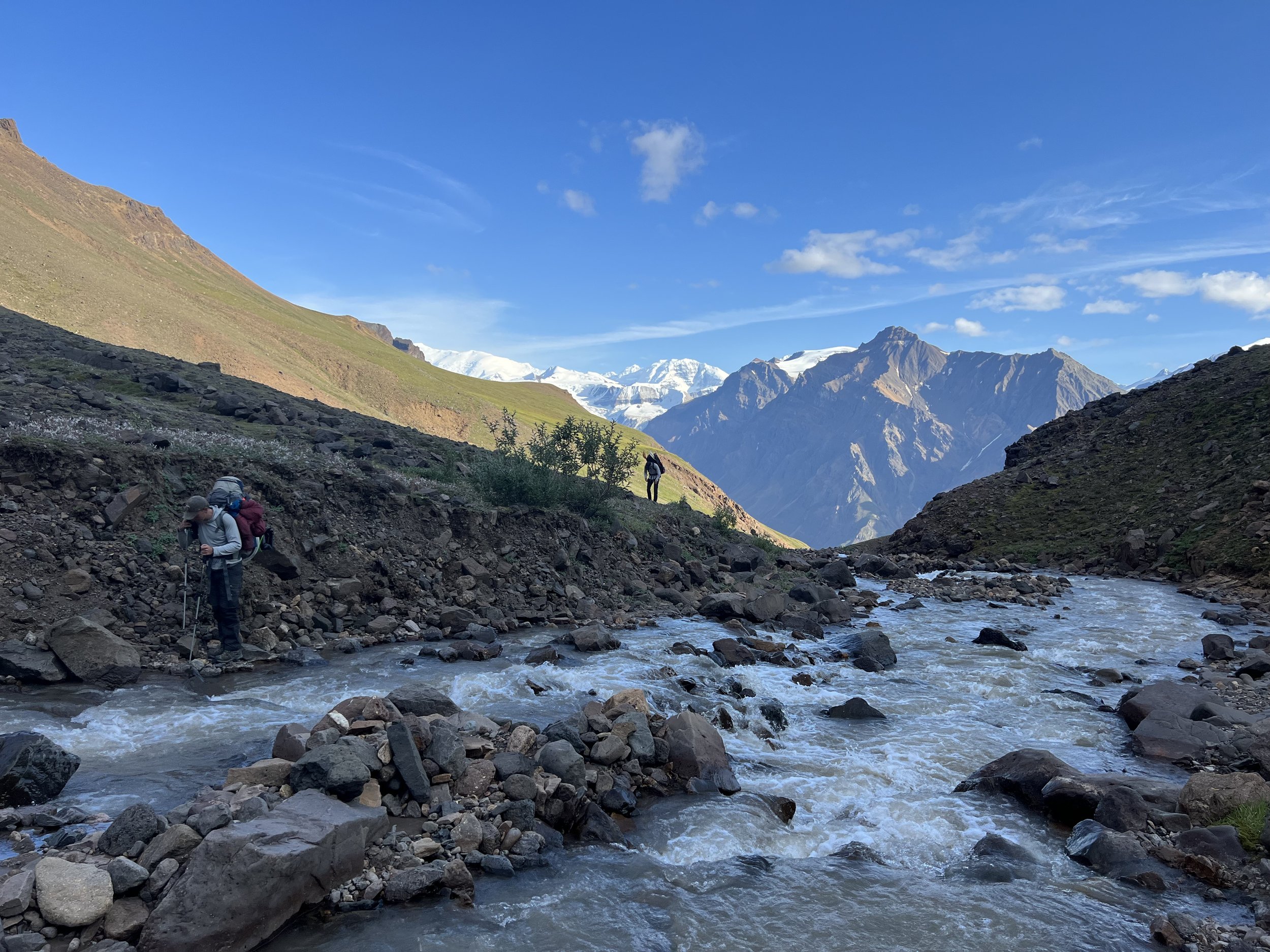
Leaving the mile-wide flat of the Nabesna behind, the next morning we started trudging up Cooper Creek to Blue Lake. Countless creek crossings made for cold, wet feet. Toward the end of the day, we came to a deep, fast-moving part of the creek which pushed along the wall of our side of the canyon. With limited options for bushwacking or a boat ferry in the narrow canyon, we decided to wade in pairs. We made it across safely, but we thought a bit harder that night about where the risk-tolerance line was, and how close to it we had come.
Over the next two days we pushed up to Blue Lake, and then over Copper Pass and down to Notch Creek. We had hoped to float down Notch Creek as soon as possible, but after seeing the low water, we knew we would have to keep walking down valley until Notch got deeper.
By the next afternoon, we were tired of carrying our boats downstream, and with a healthy dose of scrapes, we were able to cruise until the confluence with Cross Creek. As we had hoped, we were now nearly two days ahead of schedule and had plenty of time for our scenic detour to the Chisana Glacier the next morning.
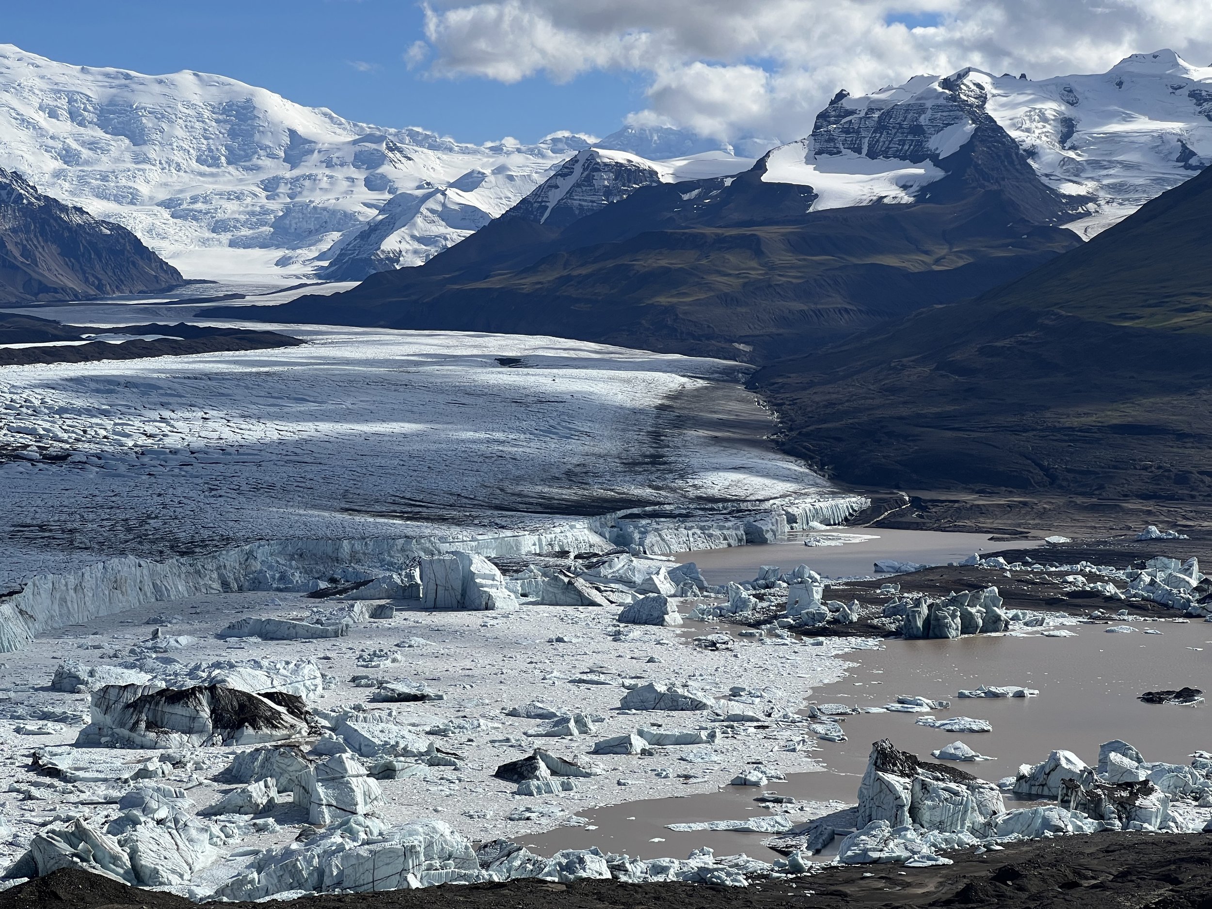
Having never seen a glacier before, we sat largely transfixed on our rest day, listening to the creaks and cracks and groans of the ice that stretched a mile across the valley. We studied its patterned ridges, its stripes of gravel frosting and puddles of deep blue on its surface.
Setting off in our packrafts from the lake at the toe of the Chisana Glacier, we decided to scout the first section of rapids when we heard the water pouring out of the lake into a narrow canyon. As we discussed our line, to our horror a huge volume of the overhung canyon wall on the far side collapsed into the river, sending large waves across the entire river. I couldn’t help but let out incredulous, terrified laughter while rejoicing the fact that I was able to portage this section.
“As we discussed our line, to our horror a huge volume of the overhung canyon wall on the far side collapsed into the river, sending large waves across the entire river.”
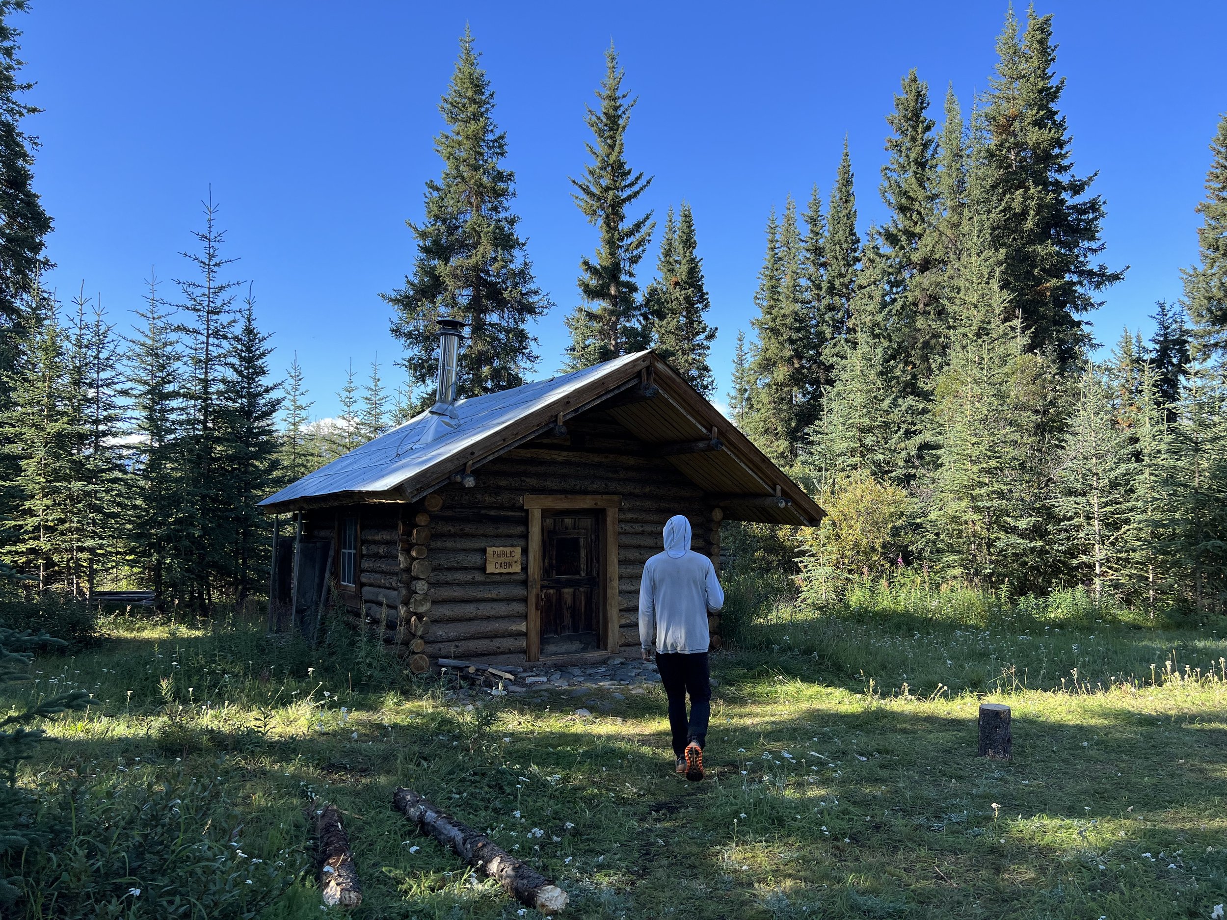
After the Chisana’s water braided out, we were treated with mellow water and incredible views. Upon arriving in Chisana that evening, we were told the public-use cabin was occupied that night for the first time of the summer, so we would have to stick around another day to hang out in the cabin. Being ahead of schedule for the food drop the next day, we made ourselves at home in Chisana and took another day of rest. We got our re-ration courtesy of Wrangell Mountain Air and quickly moved through our Oreo and Fudge Stripe supply.
Trek to Skolai Pass
Leaving Chisana behind, we found pristine walking along the gravel bars of Geohenda creek. That evening we had our first wildlife sightings of the trip, a cow and calf moose and some caribou on the ridge high above us. Veering south towards Solo pass, we enjoyed pristine alpine walking with incredible views of the glacier-covered peaks ahead of us. Our walking ended at Solo cabin, a public-use cabin donated to the park with extensive log books featuring entries from other RKMF backpacking trips.
Departing the cabin, we continued south, aiming to carefully contour the south end of the ridge of mountains to the west before dropping down to Lime Creek where we planned to camp. As enthusiasm for sidehilling wet, mossy tundra declined, we decided to go up and over an unnamed pass and drop down the other side instead of the southern traverse. On our ascent we endured brutal rain and even snow, but were rewarded with a break in the weather by the time we reached the top. With our spirits high we walked down to the confluence with Lime Creek, across which we saw three huge grizzly bears eating soapberries. We decided to give ourselves some distance before setting up camp.
From here we began our trek into the heart of the Wrangell Range, the only passage for summer hikers to cross the Wrangells without traveling on glaciers. In the morning we found ourselves unable to cross Lime Creek by foot, so set up a pendulum-belay system with a boat to get across. After a smooth crossing, we walked seven miles upstream toward the toe of the Russell Glacier, catching views of a grizzly boar, as well as a sow and her cubs along the way. Fortunately they wanted no part of our adventure.
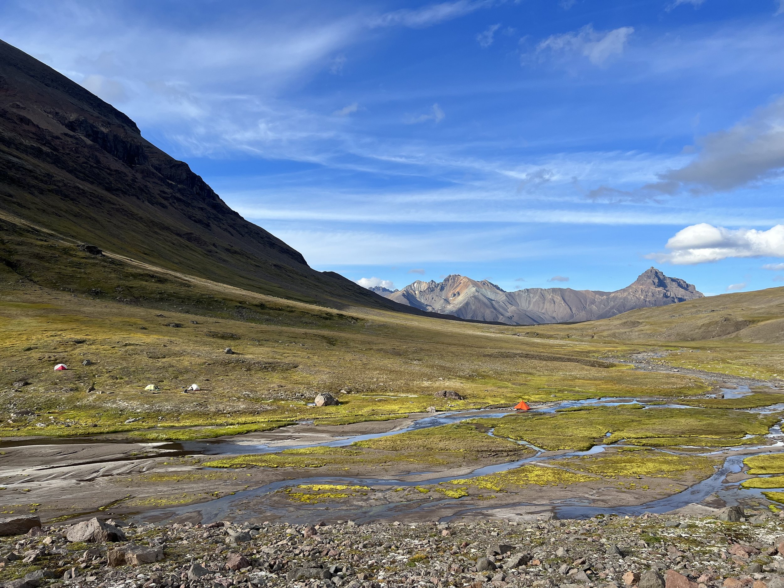
The timing of the weather couldn’t have been more ideal as we experienced clear skies and sunshine throughout the next week of the most dramatic terrain of the trip.
Our approach to Skolai Pass was short, allowing us to savor the incredible views of the glacier. The walking was a bit treacherous as we had to carefully circumvent the glacier that pushed up into the sides of the valley. As we walked we heard huge booms of crashing ice and saw many calving events leading to new icebergs flowing out of the river we had left behind that morning. After passing the glacier, we made it to the airstrip where we got our second re-ration and took another glorious rest day.
Goat Trail and Descent to Nizina
We set off with renewed energy, ascending Chitistone Pass on the Goat Trail where we saw our first mountain goats of the trip. As good campsites dwindled on the other side of the pass, we set off camp early to prepare for the big day of hiking ahead on the exposed part of the Goat Trail.
Continuing along the Goat Trail toward Chitistone Falls, we began our ascent of what the guidebooks call the “Infamous Scree Slopes.” While we didn’t have any close calls, a fall here could have been catastrophic and we were thrilled to pop over the final shoulder. Again I was left wondering if this was all ‘worth it.’ I thought a lot about all the things in life I enjoy, and how this adventure would never be worth the consequences of a fall. Victory cheese and beef jerky were in full effect, and we rejoiced in our survival with some of the most breathtaking views of the entire trip.
Departing the Goat Trail in the morning, we continued up and over a broad, shallow valley toward Doubtful Creek. The ridges above us were unique in their mesa-like flat tops which we hadn’t seen anywhere else in the park. We saw more caribou and enjoyed ideal alpine walking in the sunshine that had lasted for many days at this point.
In what would become the hardest day of the trip, we began by following the advice of multiple other trip reports by staying high above Doubtful Creek to the west across the nightmare boulder fields so as to not get cliffed-out along the creek bed. Many hours into the nightmarish, slippery boulder field we saw a route with no cliffs which would have saved us several hours. You can’t regret not having the information you needed, but it certainly didn’t improve morale.
Continuing on, we scaled numerous shoulders and walked across hellish terrain for close to eight hours, all while trying to walk six miles. As the clouds encroached the choices for route became even less apparent and we found ourselves above cliffs and landslide paths seemingly in all directions. Eventually, we backtracked and plunged down the side of a moraine with a grade just shallow enough to safely navigate. We scrambled to find camping before dark in the pouring rain along Doubtful Creek. I couldn’t wait to be at the glacier, but I feared the rising flow of the Nizina with all the rain.
The rain had continued all night and through the morning such that the creek we crossed many times the previous night was nearly uncrossable as we started walking. With treacherous slopes, and unimaginable vegetation density below treeline, we were largely trapped. Finishing the trip felt more and more like escaping. After some deliberation, we decided to make the safe choice to rig another pendulum-belay system with one of our boats and then commit to staying on the east side of the creek until the lake where we figured it would be shallower to cross. Luckily the stints of bushwashing on the east side of the creek were manageable and we were able to cross the creek at the toe of the glacier. Two mostly miserable days later, smiles started to return.
Then the sun came out! At the toe of the Nizina Glacier, we got in our boats and floated into the Nizina River. After traveling only six miles in two days, it felt incredible to move almost ten miles in an hour or two. Drifting beneath sheer cliffs and past immense waterfalls, the catharsis of leaving behind the last two days outweighed my fear of the Nizina River, now properly swollen and tumbling rocks along its bottom deep below our boats. After an idyllic campsite below the Mile High Cliffs of the Nizina, we pushed off for the final time and experienced our biggest water since the Nabesna on our first day, 22 days ago now. After several hours of intense focus navigating the low-risk, high-consequence water, the solid ground at the takeout was a true joy. All the details had worked out, and we made it. The trip was all but over.
The final morning we began our nine-mile walk into McCarthy. Exhausting our final food at lunch, we walked quickly, dreaming of what tasty treasures the general store might offer. We had two more days of eating and reflecting in McCarthy before our ride back to Anchorage on the 31st.
I don’t think my experience has an outcome, or a neat thesis, or an overarching structure. The beauty I experienced will forever have an impression in my mind, but at the end of the trip, and as I write now, I don’t plan to do something quite like this for a long time. I constantly wondered why I was carrying a boat through the most intense mountains I had ever seen. Perhaps it's simply because it was a reality I had never experienced before. And in immersing ourselves entirely within one reality, we remember all the little joys of our other lives. It is the temporality of intense moments that makes them so profound. I’m sure I will want to have an adventure of a similar magnitude at some point, but now is not that time.
“The beauty I experienced will forever have an impression in my mind, but at the end of the trip, and as I write now, I don’t plan to do something quite like this for a long time.”
This moment will be held close for the rest of our lives. We said goodbye to each other in Anchorage for what may be many months or years as our paths diverge for now. We hope to be able to experience something as unique as these three weeks again.


